Oceanscience Adds Autonomy to Z-Boat 1800


-
 Image: Oceanscience
-
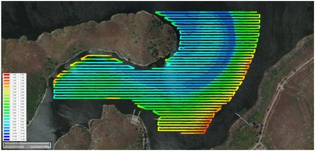 Image: Oceanscience
-
 Image: Oceanscience

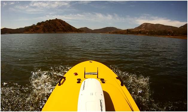
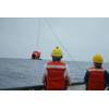
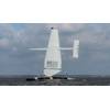
The Oceanscience Z-Boat 1800 remotely-operated hydrographic survey boat has just completed final trials with an onboard autonomous waypoint navigation system, and is now ready to get surveying. The latest GNSS controlled, IMU aided "robo" Z-Boat option is a result of a partnership between The Oceanscience Group (U.S.A.), MSubs (U.K.) and Swathe Services (U.K.) and adds autonomy to the substantial list of options for the 1.8 meters (6 feet) portable hydrographic survey system. While under manual or autopilot control, the Z-Boat can gather single or dual frequency echosounder bathymetry, side scan imagery, water quality or ADCP velocity data.
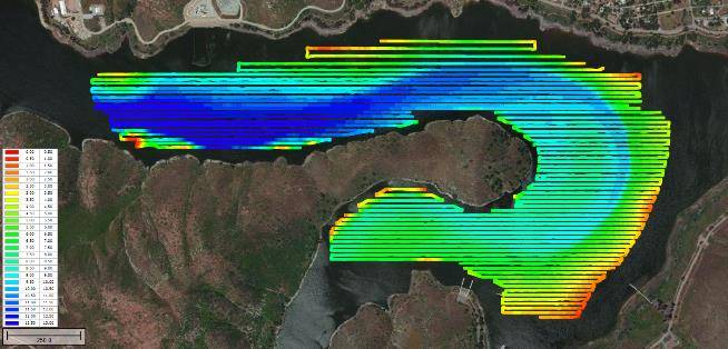
The surveys conducted with the first autonomous Z-Boats illustrate the remarkable line following performance of the MSubs autopilot, even at survey speeds up to 8kts. Cross track error is usually measured in inches and centimeters not feet or meters, and significantly exceeds the route following accuracy possible on a manned boat resulting in laser straight survey lines.
The navigation package was deliberately designed around existing hydrographic survey software. Survey line plans may be exported from HYPACK or Hydromagic directly into the Z-Boat Run Planner navigation package, and translated into navigation waypoints. With an exact match between the Z-Boat route plan and the survey line plan, data acquisition may also be completely automated. The route plan is uploaded from the shore control laptop to the Z-Boat out on the water by a radio modem system, and once the survey starts the Z-Boat operates independently of the shore controller. Data are streamed to the shore and simultaneously recorded onboard, and in case of any unexpected events the operator can switch to manual control with an “Xbox” style hand-held controller. The Z-Boat can operate well over a mile from the control station but remain in contact with the surveyor through the radio link.
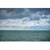
The autonomous Z-Boat option benefits surveyors conducting large area surveys on inshore waters where access for a manned boat is difficult or impossible. Operator productivity may be maximized by reducing the need for continuous attention to vessel navigation, and spectacular ruler-straight datasets can be provided to clients. Smooth heading control is particularly beneficial for side scan data from the Z-Boat, which uses hull mounted transducers. The first autonomous Z-Boats are already on their way to clients working in industrial water management and harbor surveying.
A demo survey of Lake Hodges in San Diego, with the low water level highlighting drought conditions present in California can be seen on this video:
https://www.youtube.com/watch?v=QdqzjUR5Dus
oceanscience.com