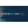
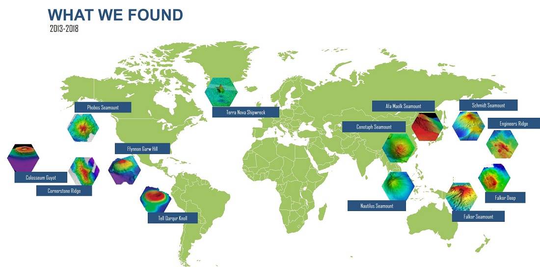
SOI Maps One Million Square Kilometers of Seafloor
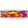
Map courtesy of SOI
Schmidt Ocean Institute, a non-profit, reached a major milestone mapping more than one million square kilometers of ocean floor, and simultaneously made a commitment to The Nippon Foundation-GEBCO Seabed 2030 Project to help create a global map of the ocean floor.
The Memorandum of Understanding will share all of its collected mapping data with the project. According to the Seabed 2030 Project, about 32 million square kilometers or 15% of the ocean has been mapped. The million square kilometer milestone is a big one for Schmidt Ocean,
accounting for 3% of this mapping contribution and the discovery of 14 new underwater features.
Seabed 2030 is a global initiative aimed at creating a detailed, freely available map of the entire ocean floor by the year 2030. GEBCO (General Bathymetric Chart of the Oceans) is the only organization with a mandate to map the ocean floor.
The organizations are working together to achieve high-resolution mapping that is needed in ocean science. “While mapping the entire ocean floor by 2030 seems like a daunting task, we are making headway thanks to the commitment of commercial, scientific and private vessels, including Schmidt Ocean Institute’s R/V Falkor,” said Seabed 2030 Director Jamie McMichael-Phillips.
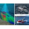
Schmidt Ocean Institute brings unique value due to its focus on mapping remote regions that require high-resolution seafloor imagery to contribute to expansion or additional protections. Some of its large mapping efforts have focused on the Papahanaumokuakea Marine National Monument in Hawaii, Cocos Island National Park in Costa Rica, and the Phoenix Islands Protected Area in Kiribati.
Gaining visuals of the ocean floor is critical to unlocking a better understanding of the world’s oceans. There are predicted to be millions of unknown species whose function and contribution to ocean and human health is still unknown. High resolution maps guide scientists to these unexplored areas where further study and sampling can take place. “A high-resolution map of our seafloor will be an invaluable tool in protecting our oceans,” says Wendy Schmidt, co-founder of Schmidt Ocean Institute.