The U.S. Navy has deployed underwater drones beneath the ice in the Arctic Ocean to assess how quickly the ice is melting and understand how soon the U.S. and Russia will be competing for strategic waterways in the region, reports Sputnik.
The drones will measure salinity and temperatures, which will help scientists, who monitor environment, create more accurate models to predict future rates of melting.
"The drones are measuring the temperature and salt content to help scientists develop more accurate computer models with which to predict the anticipated future pace of melting ice," Martin Jeffries, science advisor to the Office of Naval Research, said.
But the plans are also meant to address the "security implications" of the opening up of the Arctic waters, according to the Navy's Arctic Roadmap, updated in 2014 to adapt to changing Arctic conditions.
Part of that plan, which spans 2014-2030, is to increase the number of ships in the region, said Martin Jeffries.
Russian President Vladimir Putin’s recent aggressive stance in Ukraine has added to the urgency of this research as the Russian navy also has plans to increase their presence in the region. More Arctic Ocean waterways mean quicker and more prevalent routes for Russian ships to North America.
Less ice in the Arctic means more open water, waterways and shipping routes in the region. More open water naturally leads to increased maritime transportation and greater competition for natural resources such as oil and gas mining.
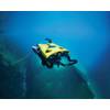
As a result, Navy scientists are using unmanned underwater autonomous robots, or drones, to examine what’s called the marginal ice zone – the portion of frozen ocean’s packed ice that meets open water, Jeffries explained.




 December 2025


