New Aerial Mapping Drone Launched
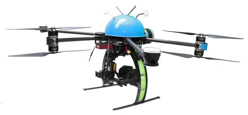
The NEXUS 800 UAV is a unique and cutting-edge mapping solution unmanned aerial vehicle (UAV) developed by HYPACK, Infinite Jib, SBG Systems and Velodyne.
- Provides a full GNSS aided inertial navigation system
- Visualizes LiDAR return with a 360 degree field of view
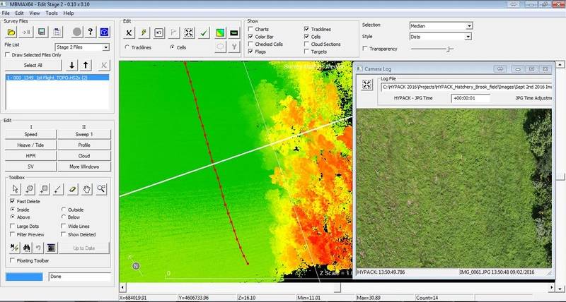
- Acquires LiDAR and Photogrammetric data using our powerful and user-friendly HYPACK-HYSWEEP software
- Displays Real-Time photogrammetry and Point Cloud viewing
- Provides Point Cloud and georeferenced photogrammetry correlation via post processing
- Includes an On-board Windows PC for rapid data processing and product creation
- Allows volume computations and data analyses
- Includes a comprehensive full flight system, training and support
See the drone in action here.







 February 2025


